
Article Author:
Christine Doka, CAC AmeriCorps Staff; Alum 2015-2018
One of the roles of CAC AmeriCorps staff is to conduct at least 2 yearly site visits for all of our members. While the idea of a “site visit” from program staff might seem intimidating, the true purpose of these is to check on regulatory requirements (is your AmeriCorps Serving Here sign up?), check in with the site supervisor, but most importantly, talk to and get to know the member a bit better to help guide them in their current projects as well as help them identify long term goals to get ready for life after AmeriCorps.

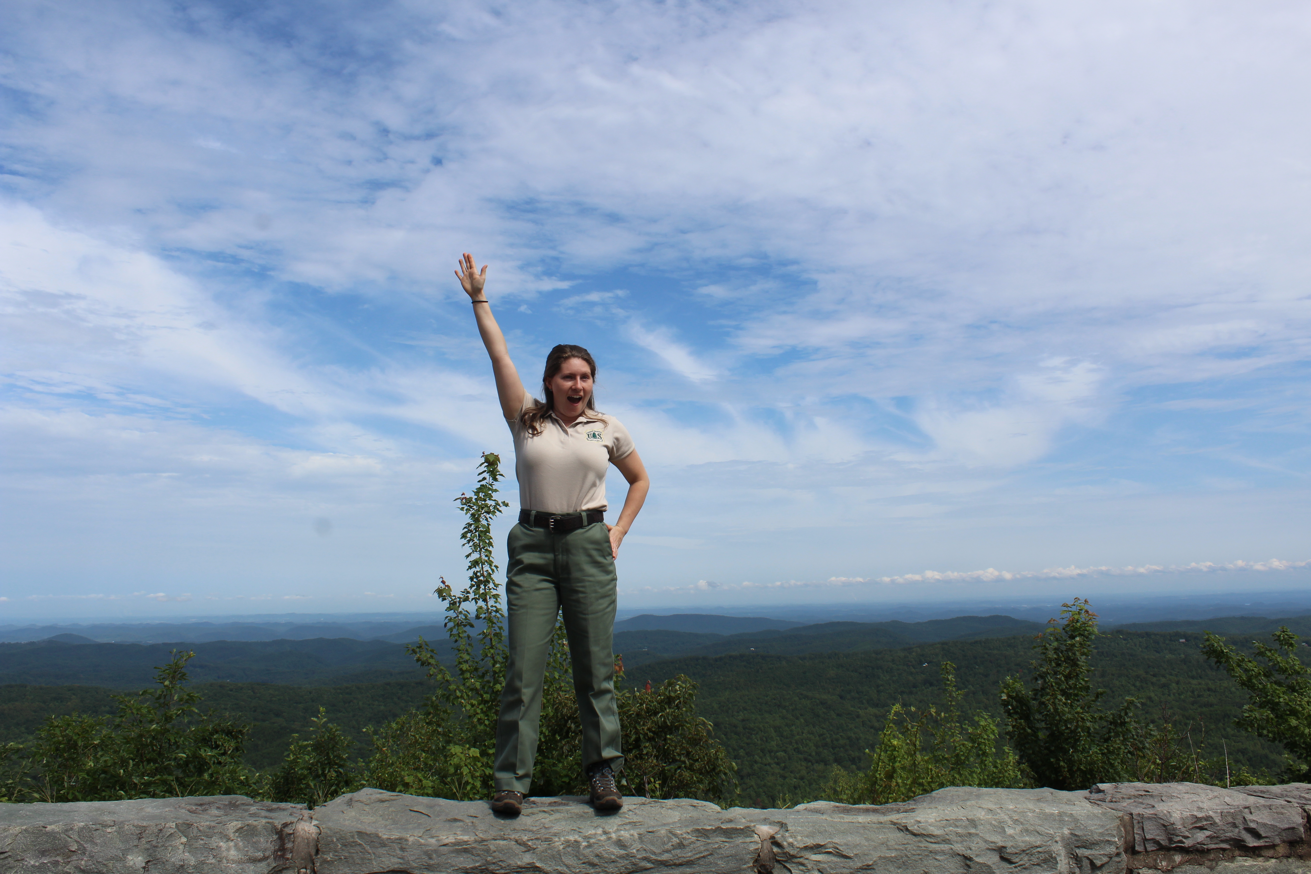
I recently had one of these site visits with Katherine Gates, who is our current member serving with the US Forest Service in Cherokee National Forest. This site is unique in that she is the only CAC AmeriCorps member serving there, and it is located roughly 1.5 hours south of Knoxville. When planning the site visit, Katherine was insistent that if I were to drive all the way down, she would love to take me on a hike and show me the beauty of where she was serving. As someone who loves spending time in nature but doesn’t get to do so often enough, I happily obliged.
The site visit began with a brief visit into her office where she showed me some of the things she’s been working on.
“I’ve collected and updated trail centerline data, and am using ArcMap GIS with a LIDAR layer to calculate slope and landform grade of all the tails in our district so we can figure out exactly where our trouble spots are, and plan reroutes accordingly. This will make natural resource management much easier because we will not have to construct and maintain trail features like water bars and grade dips because the trail, by design, will be self sustaining.”


“My supervisor also has me going every 300 feet down high priority trails and collecting soil loss data. There are large gaps in-between so it doesn’t pick up everything – it is more survey style. We are using Survey 123 for this, an Esri product, like ArcMap. Here is what that looks like,” she explained. (Pictured is Gray the trail tech, a USFS employee that goes out with Katherine to collect data).


On the way out to the hike, we spotted the Youth Conservation Corps Team that Katherine is managing over the summer, which she is enjoying.
“I get to lead them in trail maintenance and other projects, which also gives me a more well-rounded view of the forest,” she said.
About 30 minutes later we arrived at the trail head of Falls Branch Falls, which is located in the Citico Wilderness area.
At the beginning of the hike, Katherine mentioned that we might see a lot a snails, and she wasn’t kidding. Every few hundred feet we were able to observe snails of various shapes and sizes along the trail. We also enjoyed observing wildflowers and fungi, often bright and eye catching in color, trying our best to identify them and, if we couldn’t, resolving to look them up once we got back.

“We need to reroute this trail to have a more sustainable slope so the trail won’t erode away and pollute sediment in the stream, ” Katherine told me. As we descended towards our destination the air grew heavier with moisture, and it became increasingly obvious which spots on the trail could use work or be rerouted. Finally, we could hear the rushing sound of water and knew we were getting close. Katherine led the way through a gap in the rocks, and once we reached the other side we could see the waterfall through a clearing.

We hiked close enough to the waterfall to where we could feel the cool, misty breeze, which was very welcomed in the July heat. The hike back was fairly steep, so we stopped along the way to observe what was around us often.


Katherine also wanted to show me Whigg Meadow, so we took another 30 minute drive up a gravel road and came upon this sight:

Whigg Meadow is a bald located just on the Tennessee side of the Tennessee/North Carolina border. Sitting at around 5,000 feet in elevation, it provides stunning views of the surrounding mountains. The name originates from the (now extinct) Whig political party, and was named for the followers of said party that used the land for upland grazing of livestock. The practice of upland grazing in the area lasted well into the 20th century at this particular site, and was accompanied by burning.


According to Quentin Bass, an Archaeologist with the US Forest Service who graciously provided information on this history of Whigg Meadow and pictures to accompany it, grassy balds were fairly common in the southern Appalachians when upland grazing was a common practice, but now nature has reclaimed several of the balds.

Throughout her site visit, Katherine told me about all the opportunities she has had during service. She has been most impressed with all the different people, organizations,

and volunteers that come out to utilize and maintain the forest and its trails. She mentioned a few groups in particular – a horse riding group, as well as an Amish group that come to the forest for recreation regularly. As we drove past houses on the way back to the ranger station, Katherine told me about the concept of “Private Holdings” on public lands – essentially, they are private properties that are grandfathered into the protected areas. She mentioned that the next day, she and the YCC would be cleaning the Donley Cabin, which she also mentioned that based on guest

accounts, seemed to be haunted. Upon further research, I couldn’t find much about whether or not the cabin is actually haunted, but I can tell you that it was built by a man in the 1800s, who thought it would be a good place to hide to escape serving in the confederate army (he was right). It is a primitive cabin with no amenities, and you can rent a night or two in it from the USFS if you would like to see it for yourself!
 As I was gearing up to make the drive back to Knoxville, Katherine stopped me and said she had made something for our office – she had gotten a wood burning kit and burned the AmeriCorps logo into a wooden cookie – a true testament to what AmeriCorps service has meant to her. It is now prominently displayed on a shelf that is easily visible as soon as you walk in the door. Thanks for the gift and a great day, Katherine!
This blog post is a collection of personal reflections and expressions. All opinions represented are those of the author and do not represent the official opinion or views of the Knoxville – Knox County Community Action Committee, CAC AmeriCorps or any other party referenced.


You must be logged in to post a comment.